Slider

slide1

Drone Structure Scan - Derelict Cottage

Detailed 3D model of and old derelict cottage in Midvale.

slide2

Small Drone Mapping 101

The Aero Scout shares his experiences with drone mapping and 3D models.

slide3

Arthur River Mt Pleasant Kitchen - 3D drone structure scan

3D model of the heritage building Mt Pleasant Kitchen in Arthur River.

slide4

Chestnut Brae - Farm planning map in Nannup

Demonstrating how drone imagery can be used as a base for effective farm planning.

slide5

Drone Structure Scan - Heritage Lighthouse

Drone structure scan of the heritage South Mole Lighthouse in Fremantle.

Last flight of the X350 Pro

Last flight of the X350 Pro
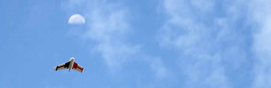
This is not my drone, I've just used this picture for emphasis, my drone is at the bottom of a winter lake.
Today was a sad day for The Aero Scout, I lost my Walkera X350 Pro in a wetlands lake. The short story is that it splashed down into the middle of the lake, never to be seen again due to a low battery .... the long story is as follows.

I knew this was going to be a challenging mission, the plan was to map a medium sized wetlands lake in Viveash. The area to be mapped was 120,000m2 (nearly 30 acres), a flight of 4.3km with over 160 images to be taken. Not only was it going to test my flight planning skills as I couldn't survey the lake with just one battery, it was going to need two, it was also going to test the post processing for the 3D map. I would need to plan for an overlap of images between the two missions so that the 3D map would be accurate, and I would need to be careful about the amount of time spent in the air because when flying over water there is no safe emergency landing zone. Clearly I hadn't anticipated all of the potential problems.

Last flight of the X350 Pro
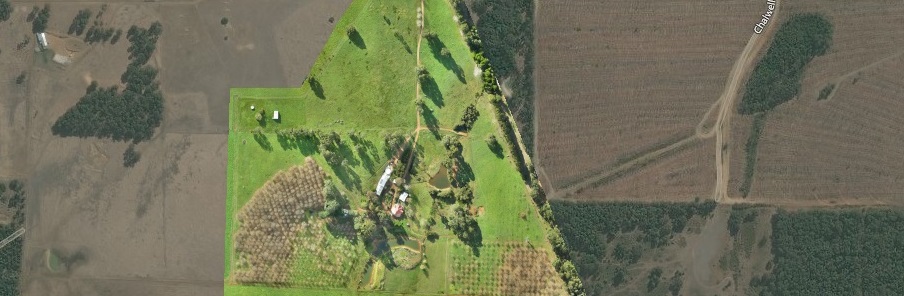
The last flight of the X350 Pro ended with the drone ditching into the middle of this wetlands.
On the day the flying conditions were less than ideal, it was hot plus we had 25-35km/h winds blowing across the lake. I'd flown the X350 Pro in windier conditions before so I wasn't too concerned, however this lack of understanding of the affect of such wind on a battery would be one of the main contributors to the crash.

In my flight planning I had a 12min flight time, which usually gives me a 3min safety margin. In hindsight, I should have taken more notice of the wind and adjusted the flight time (in the field) to be a few minutes lower, to take into account the extra power that might be used by the drone to compensate for the strong winds and stay on the flight plan it was programmed with.

Last flight of the X350 Pro
Flight plan showing the first stage of the mission 

Last flight of the X350 Pro
Flight plan showing the second stage of the mission.
Another contributing factor to the crash, I suspect, was that my batteries were getting old and probably didn't hold as much capacity as they used to. This of course would reduce the flight time that drone was capable of flying. Without any kind of telemetry system built into the drone there was no way of knowing that the battery would not last the planned flight time.

I feel either a better instinctive analysis of the flying conditions that day or a more rigorous pre-flight checklist could have prevented this incident. Plus listening to my intuition and cutting the flight short when I felt something was not right would have also helped, all I needed was another 30sec of battery and I would have had the drone over the relative safety of dry land.    

Lessons learnt:

  • Take more notice of local conditions on the day of the flight and be prepared to modify flight plan to suit.
  • Add new points to my pre-flight checklist to ensure this analysis is done for every flight, regardless of conditions.
  • Test battery capacity more often and adjust standard flight time when necessary.
  • Where possible, only fly drones that have a bi-directional telemetry link to a ground station to enable real time monitoring of the systems. This will assist the drone pilot in making better decisions during the mission.
So I've had a setback but I'm not down. I'll re-group, learn from this mistake, purchase a new drone that has greater capabilities and safety features and will then continue with my journey. Stay tuned, I'll be back in a few months with more UAV 3D mapping missions.

This has been another 'drone adventure' in aerial surveying, inspection and mapping by The Aero Scout.

Creek Line - Photomosaic from video

Preparing for a simple waypoint mission with the Cheerson CX-20

Mission Summary

  • Goal: Create an orthomosaic (stitched map) from a video instead of a series of still images 
  • Tech: Cheerson CX-20 quadcopter drone, Mobius actioncam, Mission Planner, Microsoft ICE
  • Conditions: Early morning, sunny, nil wind
  • Outcome: Microsoft ICE had no problems creating a map for a video, very easy way of creating a 'strip' map. 

My Father purchased a Cheerson CX-20 drone this week and before sending it down to him I thought I'd do some checks and some tweaks to it, so that when he received it it was 'dialled in'.

As part of the testing process I decided to send it on an auto waypoint mission. This CX-20 does not have a gimbal (plans are to use it as a fun FPV machine for now) so I created a quick angled block to face the Mobius actioncam downwards. The idea was that instead of capturing still images I would just take a video of the ground below.

Microsoft ICE (Image Composite Editor) has a great little feature for creating a mosaic (panorama) from a video. I've been eager to test this feature out and felt the CX-20 drone with a Mobius would make the fine airborne platform for such a mission.

Creek Line - Photomosaic from video
Using Microsoft ICE to create a 'strip map' using aerial video from a drone
The flight plan in Mission Planner was simple, no need for a grid layout or calculating the image lap or how many images would need to be taken. Simply create a 'one way' waypoint and set the camera to record. I thought a river or pipeline would be a good way to demonstrate this 'strip map' style of aerial surveying, however a small creek line was the easiest (and safest) example I could find.

Creek Line - Photomosaic from video
A nice simple waypoint flight plan along a creek to then create a basic photo mosaic 
See a quick video showing how the mission unfolded and then see the results in a zoomable photo mosaic below.


The photomosaic is not as high resolution as some of the other missions I have completed using the 12Mp camera, however for a 'scouting mission' I think it works well. Note; click the top right of the image to view in full screen mode.


This has been another 'drone adventure' in aerial surveying, inspection and mapping by The Aero Scout.