Slider

slide1

Drone Structure Scan - Derelict Cottage

Detailed 3D model of and old derelict cottage in Midvale.

slide2

Small Drone Mapping 101

The Aero Scout shares his experiences with drone mapping and 3D models.

slide3

Arthur River Mt Pleasant Kitchen - 3D drone structure scan

3D model of the heritage building Mt Pleasant Kitchen in Arthur River.

slide4

Chestnut Brae - Farm planning map in Nannup

Demonstrating how drone imagery can be used as a base for effective farm planning.

slide5

Drone Structure Scan - Heritage Lighthouse

Drone structure scan of the heritage South Mole Lighthouse in Fremantle.

Stel Tree - 3D Scan

Mission Summary

  • Goal:  Test photogrammetry from a smartphone
  • Tech: iPhone8s, Autodesk ReCap
  • Conditions: Early Afternoon and cloudy
  • Outcome: Handheld camera in a smartphone can be a powerful tool for reality capture

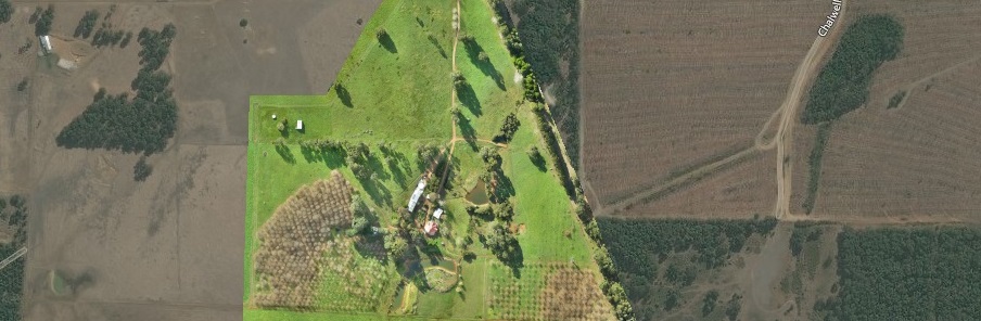
We were down at the local park for an afternoon walk, when I went to test some simple photogrammetry methodology using my smartphone daughter decided she wanted to be part of the scan.


Photogrammetry scan of tree (and daughter) using an iPhone
You can see that  whilst she assures me she did not move a muscle there is still some slight distortion around her body, whilst the tree is in near perfect focus. I guess this demonstrates how sensitive the technique is to even the slightest movement. Also see video below;